


Geological history
A fragment of Gondwana
Socotra is an ancient land: a fragment of Gondwana, the southern supercontinent, where the island sat in a central position, next to what are now Africa, Arabia, India and Madagascar.
It reached its present position 15 to 20 million years ago, when Arabia broke away from the African plate: the Gulf of Aden opened and Socotra remained on the same plate as Africa. Then the Red Sea and the East African Rift Valley began to widen, separating Arabia and the Horn of Africa even further from the rest of the continent.
Changes in sea level may at times have created a land bridge between the archipelago and the Horn of Africa, especially during the ice ages of the last 150,000 years.

The archipelago
Location and terrain
The Socotra archipelago, in the northern Indian Ocean, is made up of four islands (Socotra, Abd al Kuri, Samhah and Darsah) and two small sea stacks. Between the islands the sea is shallow, while a narrow and very deep ocean trench separates them from Africa. Abd al Kuri lies about 80 km east of Cape Guardafui, in Somalia; Socotra about 380 km south of Ras Fartak, on the Arabian coast.
1,550 m
Jebel Skand, the highest peak in the archipelago, rises above this height.
80 km
The length of the Noged plain, the largest on the island.
250 m
How high windblown sand climbs up the limestone.
Socotra divides into three zones: the coastal plains, the limestone plateau and the Hagghier Mountains, of igneous rock.
First zone
The coastal plains
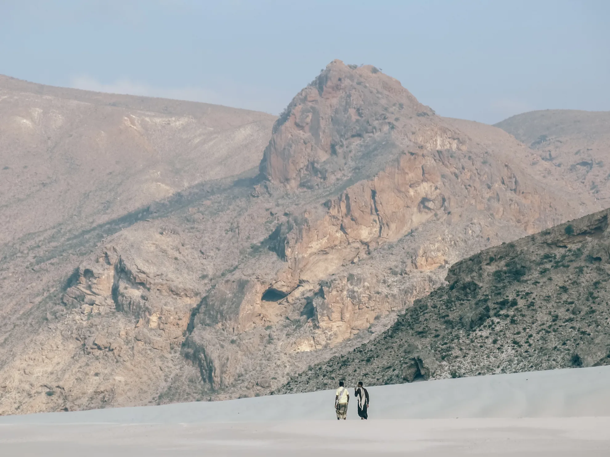
They vary in length and width, reaching about 8 km across at the widest point. The longest unbroken stretch is Noged, in the south: about 80 km long and 6 km wide on average. Elsewhere the coast alternates between short plains, rocky headlands and the escarpments of the limestone plateau.
Wadis and lagoons
The wadis, or stream beds, are mostly choked with boulders and debris. No permanent watercourse crosses the plains, though streams in flood do reach the sea. Many of those flowing north end in small freshwater or brackish lakes, cut off from the sea by spits and bars of sand.
Soils and sands
The soils are alluvial: compacted gravel, stones and coarse sand mixed with fine grey earth. In places the fine earth washed down from the interior has settled in thin layers that are important for local farming.
Windblown sand covers much of the plains, especially near Qalansiyah, at Hala on the east coast and on the Ras Hawlaf headland, where it has piled up against the limestone to about 250 metres. On the Noged plain a band of white sand, made of shells and coral, runs along the coast; further inland the yellow sand forms dunes.
Second zone
The limestone plateau
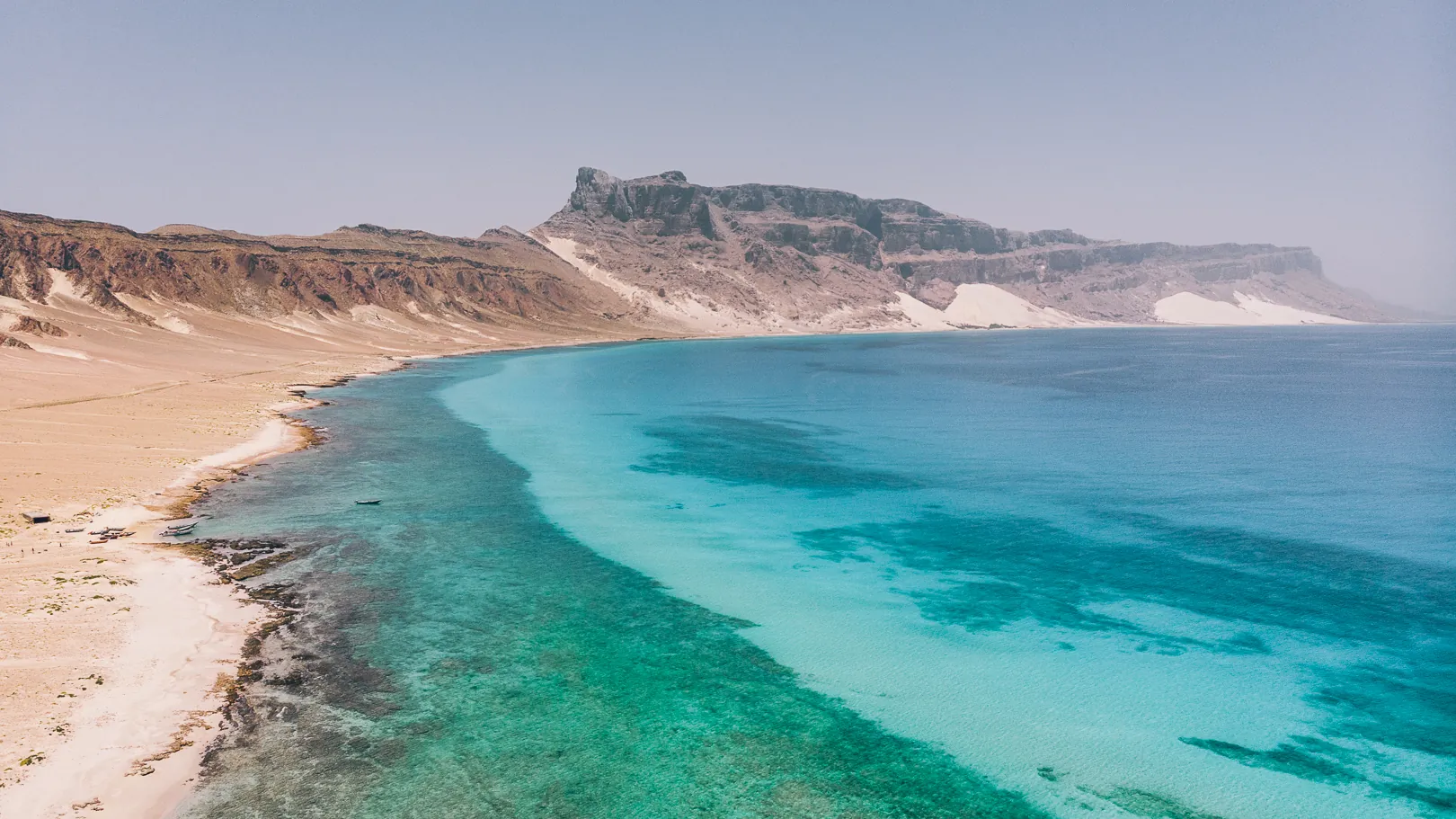
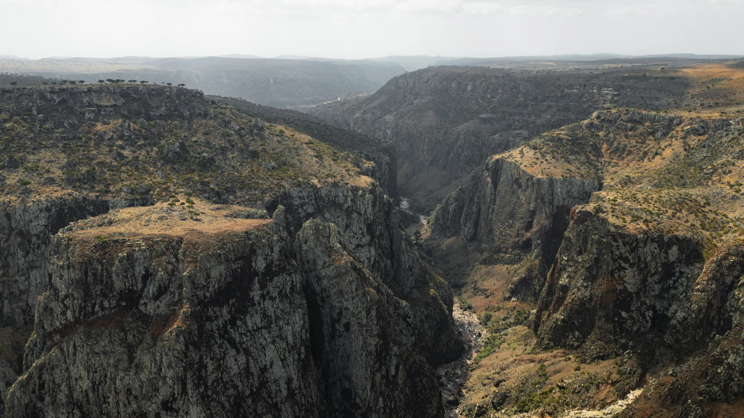
It covers much of the island at 300 to 700 metres above sea level, rising to 800 at its highest point in the west. Its edges are steep escarpments, often almost vertical, that drop to the coastal plain or straight into the sea. The wadis coming down from the central mountains, especially in the south, cut deep into it.
A karst landscape
On top, the plateau is rolling, or broken by cliffs and gorges rich in vegetation. The ground bears every sign of karst: great expanses of bare rock, furrows, shallow hollows, cliffs. Few streams run on the surface and caves are common. In the west there is a large, dry basin with almost no vegetation.

Grasslands and red earth
Elsewhere, especially in the east, soil has collected in wide, shallow basins, and broad flat grasslands open up. The soils are poorly developed, but the weathering of the limestone has left a fertile red or grey clay that gathers in cracks and hollows. In the valleys and some depressions the reddish clay lies thicker.
Third zone
The Hagghier Mountains
A plateau of igneous rock, almost all of it above 750 metres, that dominates the centre and east of the island. It is perhaps Socotra’s greatest sight.
The Hagghier rise in a series of imposing pinnacles. Below them lie deep, damp gorges, steep boulder-strewn slopes and, where the gradient eases, meadows cleared from the forest. Several peaks top 1,300 metres, and Jebel Skand, at over 1,550, is the highest point in the archipelago.
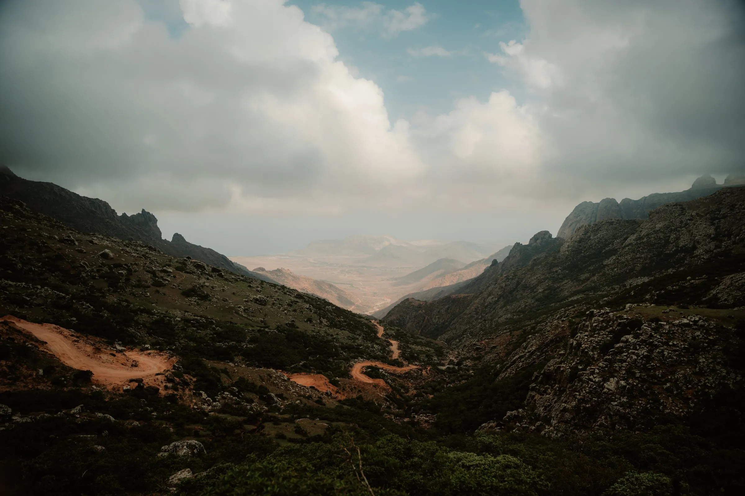
The slopes carry plenty of vegetation, and a few streams run all year round. Where the granite has weathered, in the valleys and on the gentler slopes, deep, fertile red soils have formed; on the pinnacles and the steepest slopes the soil is thin or missing altogether. The rock is mostly red, but it often looks white because of the lichens covering it.
Keep exploring the island
The mountains that never went underwater have kept plants found nowhere else in the world: discover them on the page about Socotra flora and fauna. And to understand how people live among these rocks, read about the Soqotri people or venture as far as the outer islands.